Background
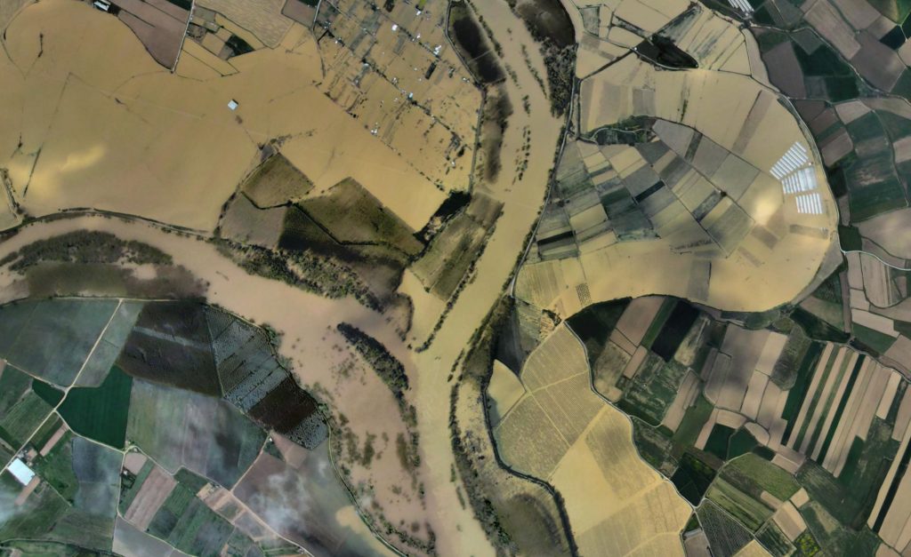
The Ebro depression is configured as a valley of soft materials and low slope surrounded by mountain ranges: the Cantabrian Mountain Range, the Pyrenees and the Iberian System. The precipitation received by these mountain systems converge in the Ebro River, whose course runs along the central axis of the valley. The low gradient of the terrain (in the 325 km that separate the towns of Logroño and La Zaida the slope is 235 m, with a gradient of 0.7 ‰) causes the river to draw large meanders that are abandoned and shaped in episodes of flooding.
The fertile soils generated in this process have been intensively used for agriculture since historical times. The combination of particularly fertile soils and irrigation water in an arid environment has resulted in the concentration of population and human activity around the river. Technological advances since the second half of the 20th century, especially the hydraulic regulation works on the most important tributaries, have taken the human exploitation of the river, the valley and its resources to previously unknown limits.
However, the middle stretch of the Ebro River has frequent floods that inundate large areas of land due to the valley’s steep slope. These floods have always occurred and there are historical references, but the most notable ones in recent decades and which are still present in the collective memory have been those of 1961, 1966, 1977, 1978, 1978, 1980, 1981, 1993, 2003, 2007, 2015 and most recently that of 2018.

Confluence of the Ebro and Aragón rivers during the flood episode of April 2018.
The protection of properties located in flood zones has consisted, over the last sixty years, in the construction of structural defense works and in the artificial maintenance of constant drainage sections, cleared of vegetation and sediments. This management model has proven to be unsustainable, as it requires large financial contributions for its recovery after each flood event.
Floods also cause undesirable social impacts, such as the displacement of populations, stress, farm failures, death or slaughter of animals, etc. These impacts on society have generated widespread unrest, leading to widespread calls for long-term solutions.
At the same time, in the last decades the Community regulations have promoted a change of focus in the management of fluvial ecosystems in order to improve and conserve their condition and mitigate risks, under the following European directives:
- Directive 2007/60/EC of the European Parliament and of the Council, of 23 October 2007
on the assessment and management of flood risks (transposed to the Spanish legal system by the
Royal Decree 903/2010, of July 9, 2010, on Flood Risk Assessment and Management). - Directive 2000/60/EC of the European Parliament and of the Council of October 23, 2000., establishing a framework for Community action in the field of water policy (transposed into Spanish law, inter alia, by the amendment of the Royal Legislative Decree 1/2001, of July 20, 2001, approving the revised text of the Water Law.).
- Council Directive 92/43/EEC of 21 May 1992 on the conservation of natural habitats and of wild fauna and flora (transposed into Spanish law by means of an amendment to the Spanish legislation).
on the conservation of natural habitats and of wild fauna and flora (transposed into Spanish law through the amendment of the
Law 42/2007, of December 13, 2007, on Natural Heritage and Biodiversity).
Following the major floods of 2015, the then Ministry of Agriculture and Fisheries, Food and Environment, the Ebro Hydrographic Confederation and the Autonomous Communities of La Rioja, Aragón and Navarra agreed to implement a plan of measures aimed at increasing the resilience of the system, applying the, at that date recently approved, Flood Risk Management Plan of the Ebro River Basin Demarcation. Thus Ebro Resilience was born.
